
Humanitarian Crisis
UNESCO: 70,000 People Face Risk of Landslides in Darfur and the Red Sea Hills
Amsterdam – September 28, 2026 – Radio Dabanga. The results of a rapid scientific assessment conducted by UNESCO have revealed...
Radio Dabanga (Arabic) September 28, 2026Published 1 views
Source:Radio Dabanga (Arabic)
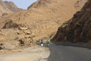
Amsterdam – September 28, 2026 – Radio Dabanga. The results of a rapid scientific assessment conducted by UNESCO on landslide risks in Sudan show that the Red Sea Hills are the region most at risk, with more than 65,336 people living in vulnerable areas. While a large part of Jebel Marra is classified as relatively stable, the risks of local debris flows associated with heavy rains could affect more than 5,021 people. The 'Tarsin' disaster in Jebel Marra was used to validate the assessment model and guide the proposed action plan. UNESCO estimates that about 70,000 people face landslide risks in Darfur and the Red Sea Hills and could directly benefit from improved risk information, awareness, and preparedness measures. UNESCO stated that, following the Tarsin disaster that occurred in August of last year, it launched a rapid scientific assessment of landslide risks in Sudan, using satellite imagery and other geospatial technologies to identify vulnerable areas and support evidence-based action. In August 2025, heavy rains caused a devastating landslide in the village of Tarsin in the Jebel Marra region of Darfur, western Sudan. According to available assessment data, the disaster resulted in the deaths of approximately 372 people, the loss of 2,348 head of livestock, and damage to 88 surrounding villages, leading to severe damage to local infrastructure and livelihoods. This tragedy, along with previous landslides in the region, highlighted the urgent need to better understand Sudan's vulnerability to such risks and strengthen preparedness in at-risk communities. Risk Assessment The organization noted that the assessment was conducted from April 3 to May 31, 2026, covering four main regions: the Red Sea Hills, the Jebel Marra massif, the Nuba Mountains, and the Ingessana Hills in Blue Nile. The assessment also challenged the assumption that Jebel Marra is the region most at risk of landslides in Sudan; while the region remains susceptible to local debris flows, the findings indicate that the Red Sea Hills face the highest overall level of risk. This underscores the importance of engaging civil defense authorities, local leaders, and communities in both regions. The assessment was implemented under the 'UNESCO Multi-Hazard and Multi-Sectoral Disaster Response for Building Back Better' project, funded by the Government of Japan, with additional support from the UNESCO Natural Sciences Sector Emergency Fund. Tarsin area in central Jebel Marra, Darfur, which was subjected to landslides - screenshot from a video circulating on social media. Awareness Activities UNESCO is collaborating with the Regional Center for Science and Technology to conduct the assessment and support the development of an emergency action plan. The Sudan Action Plan (2025-2027) recommends establishing a Disaster Risk Reduction Task Force and prioritizes four areas of intervention: creating a two-tier early warning system to enhance preparedness and enable timely action, raising community awareness on landslide prevention, preparedness, and emergency response, as well as strengthening engineering measures and ecosystem-based disaster risk reduction approaches, in addition to conducting further geological assessments, continuous monitoring of environmental conditions, and strengthening land-use planning to prevent settlement in high-risk areas. The planned awareness activities will target about 65,000 people at risk in the Red Sea Hills. Plans are also in place to produce a documentary film and conduct media interviews to improve public understanding of landslide risks and available mitigation measures. Beyond scientific work, UNESCO supported awareness-raising and stakeholder engagement activities in January and February 2026 through the 'Environmental Khartoum' initiative. Awareness activities reached over 250 people in Khartoum, reinforcing the importance of addressing climate-related risks and strengthening disaster preparedness as national priorities. Expanding Risk Assessment Within the framework of this project, UNESCO also conducted field visits along the highway connecting Haya and Atbara, as well as in nearby mining areas. These visits helped identify additional environmental and geological risks and highlighted the need for continued monitoring in areas where local communities, transport routes, and economic activities may be at risk.
Radio Dabanga (Arabic)الأخبارالخبر الرئيسيالصفحة الرئيسيةسياسةشريط الأخبارعناوين الأخبار
Share
Comments
No comments yet. Be the first to share your thoughts.
Subscribe to our newsletter
Get a summary of the latest news and analysis delivered to your inbox.